ligo.skymap: Advanced Python Tools for Probability Sky Maps
The ligo.skymap Python package includes a number of advanced tools for working with GW probability sky maps.
Publication-quality astronomical mapmaking built on Astropy (
ligo.skymap.plot.allsky)
Functions for manipulating distance posteriors (
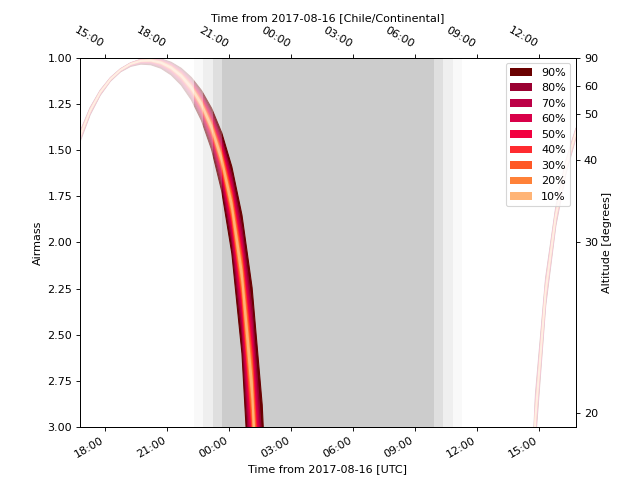
ligo.skymap.distance)Probabilistic airmass plots (ligo-skymap-plot-airmass)
The rapid sky localization code BAYESTAR, which is used to produce the initial sky maps for CBC events but can also be used to create simulated sky localizations.
The postprocessing tool that creates updated sky maps from MCMC samples (ligo-skymap-from-samples)